If you are thinking about moving to Fort Washington, one question matters fast: what does daily life actually feel like once you factor in the neighborhood layout and the commute? That is especially important here, because Fort Washington is not built around one compact downtown or one single housing type. Instead, you will find a mix of residential pockets, office-centered corridors, rail access, and major road connections that shape how people live and move. This guide breaks down the main areas, housing patterns, and commute routes so you can make a more confident decision. Let’s dive in.
Fort Washington at a Glance
Fort Washington is a community with deep local history and a very practical modern identity. It was settled in the 18th century and is tied to Revolutionary War history, according to the Fort Washington historical records at Penn Libraries.
Today, Fort Washington sits within Upper Dublin and Whitemarsh townships and is strongly shaped by its transportation access and employment base. Census Reporter estimates about 6,271 residents, a median age of 45.9, and a median household income of $166,321, which gives you a useful snapshot of the area as you start your search.
How Fort Washington Is Organized
One of the most helpful things to know is that Fort Washington does not always read like a town with rigid, easy-to-define neighborhood lines. Because the community spans more than one township and includes a major office and transit corridor, it often makes more sense to think in terms of residential pockets and commuting zones.
A map-based housing source identifies practical pockets such as Town Center, Fort Washington East, and Broad Axe/Lancasterville. These are best understood as functional areas rather than formal municipal neighborhoods, based on how the community is laid out and how people use it day to day.
Main Residential Pockets
Station and Office Core
If commute convenience is high on your list, the station and office-park core is one of the most important areas to understand. SEPTA connects Fort Washington Station and Route 201 with the surrounding office park and major roads including Station Avenue, Pennsylvania Avenue, Delaware Drive, Office Center Drive, Camp Hill Road, Susquehanna Road, Commerce Drive, Virginia Drive, Bethlehem Pike, Limekiln Pike, Fort Washington Avenue, and Highland Avenue.
This part of Fort Washington tends to feel the most tied to everyday movement. If you want easier access to rail service, office destinations, and nearby services, this pocket often becomes a natural starting point.
Craig-Y-Nos Area
Craig-Y-Nos is one of the more clearly defined residential pockets in Fort Washington. Upper Dublin describes it as the area bounded by Twining Road, Susquehanna Road, Jeffrey Drive, and rear lots toward Limekiln Pike.
For buyers, that matters because it gives a more concrete sense of place than some broader local labels. If you are comparing sections of Fort Washington, this is one of the few areas with a specifically described boundary reference.
Town Center and East-Side Pockets
Other local pocket names, including Town Center and Fort Washington East, can be useful for online searching and broad orientation. These labels may help you narrow inventory patterns, but they should not be treated as strict legal neighborhood lines.
In practical terms, these areas reflect how homes, roads, and daily travel patterns cluster. When you tour properties, it helps to pay attention not just to the label but to how close the home sits to rail access, major roads, and your most common errand routes.
Broad Axe and Lancasterville Pocket
Broad Axe/Lancasterville is another label that shows up in map-based housing data. As with the other broader Fort Washington pocket names, it works best as a directional tool rather than a formal boundary.
If you are relocating from outside the area, this is a good reminder that a local guide can help translate online map labels into what actually matters for your routine. In Fort Washington, your day-to-day experience often comes down more to access and housing style than to a single neighborhood name.
What Homes Look Like Here
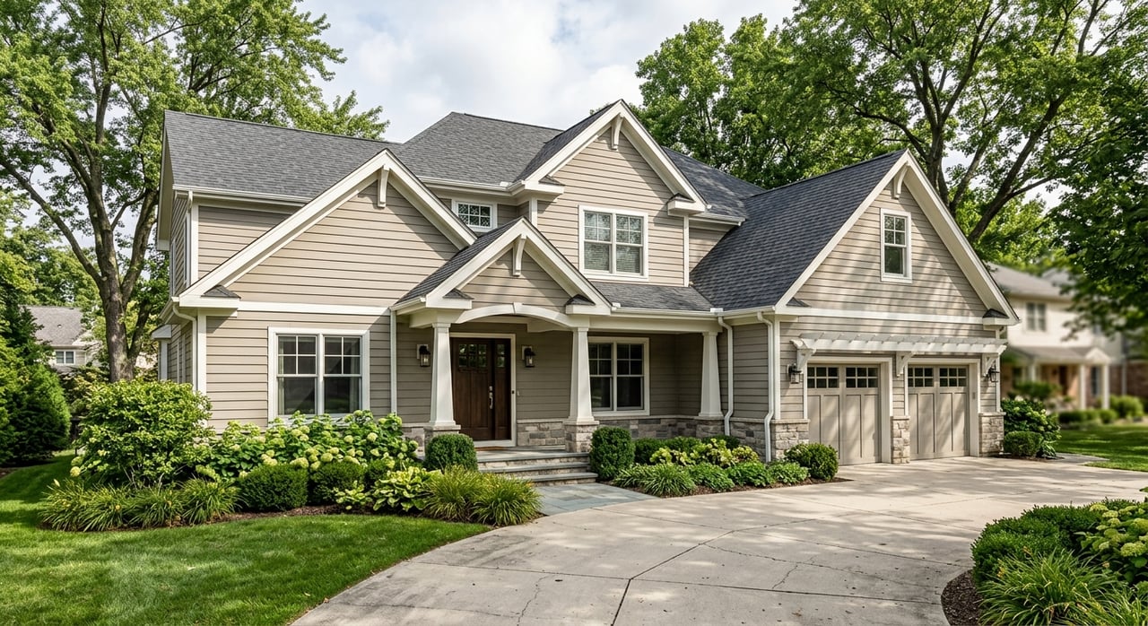
Fort Washington offers a mix of housing types rather than one dominant product. According to NeighborhoodScout housing data, about 69.9% of housing units are single-family detached homes, 12.0% are townhomes, 7.0% are small apartment buildings, and 11.1% are apartment complexes.
That variety can be helpful if your needs are changing. Whether you are looking for a detached home with more space, a townhome with simpler upkeep, or a multifamily-style option near commuter routes, Fort Washington gives you several formats to consider.
Typical Home Size and Ownership Pattern
The same source notes that owner-occupied three- and four-bedroom homes are the most prevalent home type, primarily in single-family detached properties. For many buyers, that points to a suburban housing profile with larger homes still playing the biggest role in the local inventory mix.
At the same time, the presence of townhomes and apartments adds flexibility. That can appeal to first-time buyers, relocators, and downsizers who want Fort Washington access without focusing only on larger detached homes.
Housing Age and Character
Fort Washington also has a mostly postwar housing profile. NeighborhoodScout reports that 35.3% of homes were built between 1970 and 1999, 32.5% between 1940 and 1969, 19.7% before 1940, and 12.4% in 2000 or later.
For you, that means the housing stock may include a broad range of styles, layouts, and update levels. Some homes may reflect mid-century or later suburban development patterns, while others may offer older character or newer construction features.
Commute Options in Fort Washington
For many buyers, Fort Washington stands out because it offers both rail and highway access. That flexibility is one of the area’s biggest practical advantages, especially if your work, family, or lifestyle requires movement in more than one direction.
SEPTA Rail Service
SEPTA lists Fort Washington on the Lansdale/Doylestown Line, with service to and from Center City Philadelphia. The station is identified as a zone 3 stop, which is useful if you are comparing fare structure and trip planning with other suburban locations.
If you work in Philadelphia or want a rail option available, this is a key part of Fort Washington’s appeal. Even if you do not ride every day, having a nearby regional rail connection can widen your options.
Local Bus Connections
In addition to rail, SEPTA says Fort Washington is served by bus routes 94, 95, and 201. The Route 201 map is especially helpful because it shows how local service links the station with Fort Washington Office Center, Maplewood Office Park, Temple University Fort Washington, and several major roads through the area.
That local connector matters because it helps explain how Fort Washington functions. It is not just about getting to Center City. It is also about moving between work, transit, and daily destinations within the broader corridor.
Driving Routes and Regional Access
If you drive, Fort Washington is heavily shaped by Route 309 and the Pennsylvania Turnpike. Upper Dublin notes that the Fort Washington Office Park sits at the crossroads of the PA Turnpike and Route 309, which helps explain why the area is such an important regional employment center.
For toll-road users, the 2026 Pennsylvania Turnpike toll schedule identifies Fort Washington as Exit 339. PennDOT has also highlighted the importance of this corridor through its Route 309 resurfacing project notice, which covered a 10-mile section through Upper Dublin, Whitemarsh, and Springfield townships.
What the Daily Commute Feels Like
Fort Washington works well for people who want options instead of one single route pattern. Some suburbs depend almost entirely on driving, while others revolve around a walkable center and a train stop. Fort Washington sits in between, with daily movement organized around major corridors, office destinations, and transit links.
That layout can be a good fit if your week varies. You might drive some days, take rail on others, and keep many errands within the broader office and roadway corridor.
Average Travel Time Baseline
Census Reporter lists a mean travel time to work of 24.6 minutes. That number will not predict your personal commute, of course, but it gives you a useful baseline when comparing Fort Washington with other nearby suburban markets.
If you are choosing between communities in Montgomery County or nearby Bucks and Chester County areas, that type of benchmark can help you frame your search in a more practical way.
Office Park Influence on Daily Life
The Fort Washington Office Park is a major part of how the area functions. Upper Dublin describes it as a 536-acre multi-use business hub with roughly 6 million square feet of commercial space, located about 14 miles from Center City Philadelphia.
Because the office-park corridor also includes dining, hotel, and recreation uses, some everyday trips may stay within the broader employment center. If you value convenience near work-related services or prefer a suburb with strong regional connectivity, this can be a meaningful advantage.
How to Choose the Right Pocket
The best part of Fort Washington for many buyers is flexibility. The challenge is that flexibility can feel harder to decode online unless you know what to compare.
As you narrow your search, focus on the factors that will shape your routine most:
- Train access: How important is SEPTA regional rail for your schedule?
- Highway convenience: How often will you use Route 309 or the Turnpike?
- Home type: Do you want a detached home, townhome, or lower-maintenance option?
- Daily routes: Where do you need to get quickly on weekdays and weekends?
- Neighborhood feel: Do you prefer a more tucked-away residential pocket or a location closer to the office and transit corridor?
When you weigh those questions together, Fort Washington becomes easier to understand. It is less about one headline neighborhood and more about finding the right balance of home style, access, and rhythm.
Why Fort Washington Appeals to Buyers
Fort Washington can attract a wide range of buyers because it combines established suburban housing with strong transportation access. You have a community with historical roots, a substantial employment center, rail service, major road links, and a mix of home types.
That combination can work well for move-up buyers, downsizers, first-time buyers exploring suburban options, and relocators who want to stay connected to Philadelphia and the surrounding counties. The key is understanding how each residential pocket relates to your everyday routine.
If you want help sorting through Fort Washington neighborhoods, commute patterns, and home options, Jaime E Lipson can help you compare the details, narrow your search, and move forward with confidence.
FAQs
What are the main neighborhood areas in Fort Washington, PA?
- Fort Washington is often understood through practical residential pockets such as Town Center, Fort Washington East, Broad Axe/Lancasterville, the station and office core, and the more clearly defined Craig-Y-Nos area.
What commute options are available from Fort Washington, PA?
- Fort Washington offers SEPTA Regional Rail on the Lansdale/Doylestown Line, bus routes 94, 95, and 201, plus convenient driving access to Route 309 and the Pennsylvania Turnpike.
Is Fort Washington, PA good for Philadelphia commuters?
- Fort Washington can be a practical choice for Philadelphia commuters because SEPTA serves the area with regional rail to Center City, and the community also has strong highway access.
What types of homes are common in Fort Washington, PA?
- Single-family detached homes make up the largest share of housing in Fort Washington, with townhomes, small apartment buildings, and apartment complexes also part of the local mix.
How long is the average commute from Fort Washington, PA?
- Census Reporter lists the mean travel time to work in Fort Washington at 24.6 minutes, which can serve as a general comparison point when evaluating the area.
What makes Fort Washington, PA different from other suburbs?
- Fort Washington stands out for its mix of residential pockets, major office-park presence, SEPTA rail access, and location near Route 309 and the Pennsylvania Turnpike rather than a single compact downtown.